Basic Innovative Techniques
This section introduces some very simple but innovative ways of presenting design data. These techniques require third party applications that are free or very reasonably priced. Links to vendors can be found in the Links section and demos are available by clicking on the indicated images (or right clicking and selecting Save target As...).
Adobe Acrobat 7 Reader Export
There is a new feature being adopted into Adobe Acrobat 7- 3D interactive display. The technology is based on the U3D, or Universal 3D format developed by Microsoft. The latest version of Microstation V8, 2004 Edition, can create a PDF document with a 3D Microstation file incorporated into it. When viewed in Acrobat Reader 7, the recipient can interact with the model, or play pre-defined animation that was set up in Microstation. There are some good examples on Bentley's site (see Links section or the Related Links section to the left for some demos). This capability will allow the designer to send 3D interactive views of their project to anyone who has the latest Adobe Reader. The print function even has a polygon reduction tool built in. Below is a screen grab of a sample on the Bentley site which shows 3D content inserted in with text in a PDF document. Predefined views can be set up to be available from a pulldown menu.
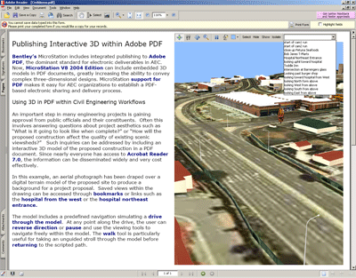
(you must have Acrobat Reader 7.0 installed)
Here are the basic steps. The PDF file is created using a Bentley print driver. Access the Print dialog by pressing the Printer icon, or through the File menu
FILE>PRINT
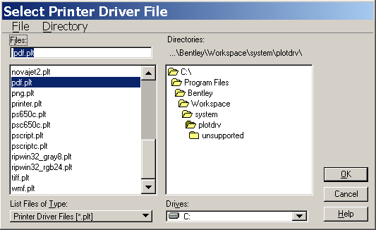
Select a Bentley driver under the dialog's File menu:
FILE>SELECT BENTLEY DRIVER
select the PDF driver:
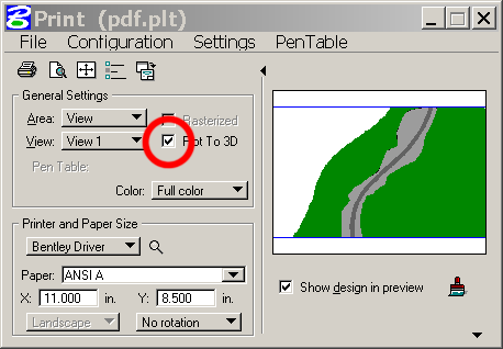
The printer dialog will now have a Plot to 3D checkbox- make sure it is checked:
On the Settings menu pull down on the Print dialog select 3D Plotting:
SETTINGS>3D PLOTTING
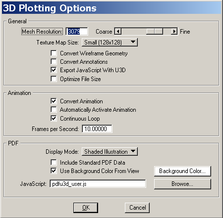
By sliding the Mesh Resolution setting from Coarse to Fine, the density of the geometry in the PDF can be controlled. The suggested default is 1000. The Texture Map Size setting will force all maps in the model to a fixed, small size.
There are a couple of display render modes available, Shaded will be the most commonly. The Shaded Illustration option is a nice feature that renders the 3D model in an outlined shaded mode, like a 'cartoon' render, similar to the Filled Hidden Line mode in Microstation. The background color for the PDF file can be set here as well.
Below is a screen shot of a sample PDF file produced by 'draping' an aerial over a TIN. There are basic navigation controls over the image that allow the user to pan, zoom, rotate and fly. Elements in the scene can be turned on and off.
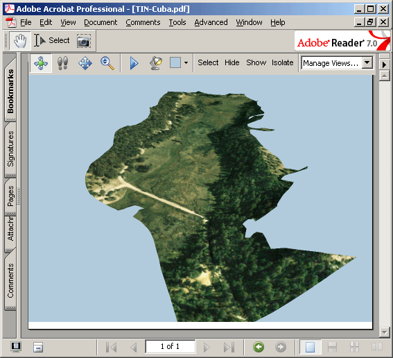
Some other sample files are available on the Bentley site. Some show content that includes annotation added in Acrobat 7. The PDF produced in Microstation can be edited in Acrobat, or a U3D file can be exported from Microstation and inserted into an Acrobat document.
VRML Export
VRML has become a popular format for distributing 3D content over the web for realtime playback. There are several free plugins that play VRML files in most browsers. The better plugins support camera based views, animation, and texture mapping and lights. VRML nodes can include switches for objects in the scene, and links to other VRML nodes. A commonly used viewer is Cortona by Parallel Graphics.
Microstation has a very robust VRML exporter built in that will allow export of animation, views, and textures.
Microstation export is accessed through the file pull down:
FILE>EXPORT>VRML WORLD
Click in the viewport with the desired initial view for the model, and the following dialog comes up:
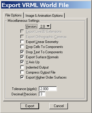
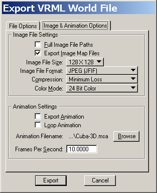
VRML version 2 is relatively well supported, but for older plugins, V1 is safer.
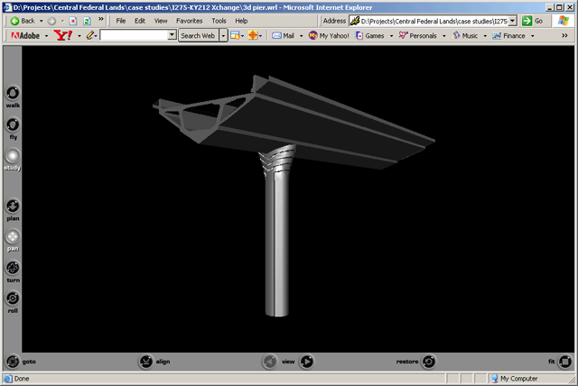
Here is a screen grab of the pier model being viewd in the Parallel Graphics Cortona VRML viewer. The viewer has buttons for basic navigation and preset camera views
Keyhole
Keyhole is an interactive streaming GIS data server that was recently purchased by Google. The base viewer is an inexpensive product that lets the user zoom to an aerial view of any location for which there is satellite data coverage. Coverage resolution varies from location to location, but most urban areas in the U.S. are represented by 1-meter or less aerial imagery. The main issue with FLHD projects will be coverage for projects in remote areas.
The viewer can be used to explore areas, or to create simple annotated presentations of specific areas. Existing overlay information for things like roads, transit, landmarks, etc. are included for optional display.
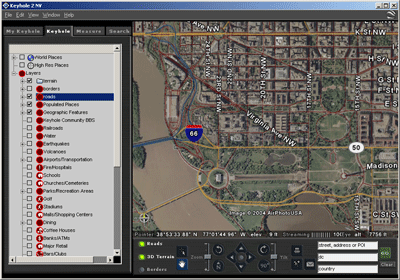
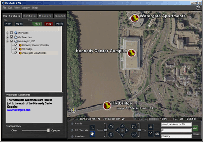
The basic Keyhole application allows the user to add in placemarks with notes and links, and simple presentations can be made by jumping from placemark to placemark (with a double click).
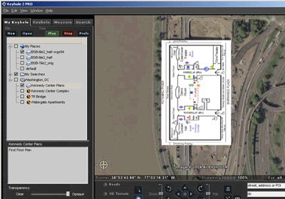
Overlay images- such as drawings or maps can be inserted and aligned to the aerial in Keyhole, and switched on or off fro comparison.
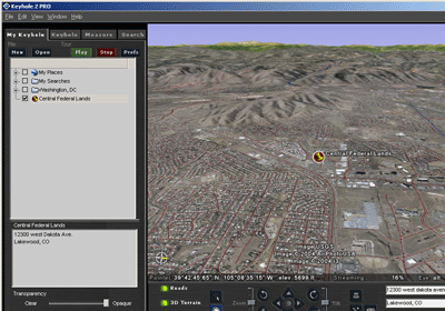
3D display of terrain data can be turned on where applicable. The 2D image data, including any overlays, is draped over the 3D terrain model.
The authoring versions of the application, Keyhole Pro and EC, allow for the import and display of georeferenced data such as geotiffs, Arcview shape files, Microstation drawings with associated geo-referencing, etc. The files are reprojected by Keyhole and automatically displayed in the proper location and scale. Animated fly-throughs from location to location can be exported directly from the pro version of the software. The application makes for a very powerful presentation tool.
