USA Banner

Official US Government Icon

Official websites use .gov
A .gov website belongs to an official government organization in the United States.

Secure Site Icon

Secure .gov websites use HTTPS
A lock ( ) or https:// means you’ve safely connected to the .gov website. Share sensitive information only on official, secure websites.

U.S. Department of Transportation U.S. Department of Transportation Icon United States Department of Transportation United States Department of Transportation

Noteworthy Practices

Left Nav - HSA Learn Safety

Linking Law Enforcement and Roadway Safety in Maryland


Background

There are numerous strategies and infrastructure improvements that can reduce crash fatalities and serious injuries. But to have a real impact on crash rates, it also takes strong communication between law enforcement, who see firsthand the consequences of severe crashes, and engineers, who know the science behind efforts to reduce the worst crashes.

In Maryland, as in many States, there is often turnover in leadership of Statewide traffic police units, making it difficult to establish lasting connections between law enforcement and highway planners. That's why nearly a decade ago the Maryland Highway Safety Office (MHSO) developed a comprehensive training program for traffic commanders that melds police work with concepts such as strategic planning and data-driven decision making that are more often the purview of engineers.

Leading Effective Traffic Enforcement Programs

Maryland's traffic commander leadership program is called the Leading Effective Traffic Enforcement Program (LETEP). Since LETEP was founded in 2008, there have been nearly one dozen classes with up to 25 traffic police commanders in each, including commanders from outside Maryland.

The program has been refined with insights from past students, experts outside the law enforcement community, and curriculum consultants. The LETEP approach is unique because it trains traffic police leaders on the importance of roadway design and safety concepts, so that officers in the field play a key role in identifying and reporting roadway safety needs, such as dangerous intersection or curves.

Traffic officers are trained in basic engineering concepts and effectively become another set of eyes to inform infrastructure improvements and crash reduction strategies. LETEP also trains officers and leadership how to think beyond the traffic ticket: the core of the curriculum is about encouraging law enforcement to go beyond traditional police work and ask why; to consider how and if their work is having an impact on reducing serious crashes.

Maryland is also unique in that representatives from law enforcement lead several of its State Highway Strategic Plan (SHSP) emphasis areas. Of the state's six emphasis areas, four are behavioral (aggressive driving, distracted driving, impaired driving, occupant protection) and two are engineering related (highway infrastructure, pedestrian crashes), demonstrating the range of safety areas and strategy-making where law enforcement is involved.

LETEP Challenges

The LETEP curriculum is mature and is a proven, effective way to mesh the goals of law enforcement leadership and traffic engineers. But, the real-life responsibilities of traffic divisions can differ greatly. A traffic division in a city, for instance, may be constantly working to make sure that events such as fairs, races, and baseball games are safe. They may be so pressed to maintain safe movement within their city that they do not have the bandwidth to proactively link their daily work with long- and short-term engineering solutions that can improve traffic safety.

While the results of the LETEP program can depend greatly on size, perspective, and agenda of specific law enforcement agencies, MHSO staff have developed personal relationships with every senior law enforcement executive in Maryland. Open channels from traffic planners to traffic enforcement leadership can help develop solutions for traffic divisions that find it difficult to implement LETEP insights.

LETEP Benefits

  • After completing LETEP, traffic commanders have a fuller understanding of the “science” behind behavioral traffic safety countermeasures.
  • This training provides traffic commanders with an understanding of how to better target their efforts for an impact on safety—for instance, by utilizing geospatial crash analysis tools to identify problem areas so as to direct sufficient resources to those areas utilizing appropriate countermeasures.
  • Develops an expertise in Strategic Traffic Safety Planning including vigorous evaluation of their efforts.
  • Provides police commanders an understanding of basic engineering concepts, so they can act as another set of eyes in the field.
  • Encourages police commanders to become more safety proactive. If they recognize that they are often called to crashes at a particular left turn intersection, they can be proactive and communicate that insight to engineers.
  • Provides law enforcement an understanding of the state's Strategic Highway Safety Plan, and how this plan guides local efforts. It also encourages their active involvement in the plan's development as well as its implementation through participation in Emphasis Area Teams.

Contact

Tom Gianni
Chief
Maryland Highway Safety Office
410-787-4014
TGianni@mva.maryland.gov
New Hampshire Tackles Distracted Driving through New Hands-Free Electronic Device Law


Background

On July 1, 2015, New Hampshire joined a growing number of States that have enacted laws banning hand-held electronic device use while driving. A previous law in New Hampshire banned texting while driving, but it was difficult to enforce. Drivers often texted while keeping their phones out of view of law officers—if they were pulled over, they would argue that they were making a phone call, which had been legal.

State police leadership and the State Attorney General's office pushed strongly for and helped write New Hampshire's hands-free law. To educate the public on the new law and the potentially fatal consequences of distracted driving, New Hampshire Department of Transportation (NHDOT) has pursued a comprehensive regional marketing campaign—branded as Hands-Free New Hampshire—across radio, television, social media, and web platforms.

A Marketing Push for Safer Driving

Hands-Free New Hampshire is part of a broader road safety effort in New Hampshire called Driving Toward Zero. That effort aligns with the Federal Highway Administration’s Toward Zero Deaths strategy, and promotes a safety culture where the only acceptable number of yearly road fatalities is zero.

Driving Toward Zero programs emerge from collaboration with more than a dozen public and private organizations, including the American Automobile Association (AAA), the Bike-Walk Alliance of New Hampshire, the New Hampshire State Liquor Commission, and the New Hampshire Automobile Dealers Association (NHADA).

Through these alliances, information about hands-free driving is spreading beyond NHDOT's direct efforts. Posters and brochures have been posted and distributed on the web and at physical locations of NHADA, the Brain Injury Association of New Hampshire, New Hampshire Association of Chiefs of Police, the Dartmouth-Hitchcock Medical Center, and numerous town police headquarters.

Communications consultants work with NHDOT to advance the hands-free campaign and to create promotional materials, including two television public service announcements that run on local cable networks. Across the landscape of State road safety efforts New Hampshire is particularly proactive in working with consultants to promote safe driving practices. NHDOT uses Highway Safety Improvement Program funds to pay for the expertise and media contacts that communications consultants provide.

Targeted Marketing

Because less-experienced, younger drivers are nearly three times more likely1 as more experienced drivers to have a fatal crash, NHDOT has focused specific efforts to reduce distracted driving among teens. Driver education instructors incorporate distracted driving lessons and information about New Hampshire's hands-free law into their curricula. A safe driving pledge card serves as a conversation starter to engage young people in thinking about their choices behind the wheel.

At conferences held twice per year, driving instructors, school administrators, and NHDOT staff discuss new initiatives to combat distracted driving. NHDOT provides instructors with the latest posters, flyers, and videos to share with their students. The University of New Hampshire (UNH) is also part of the Driving Toward Zero coalition. Drivers at UNH who are slightly older, but perhaps still inexperienced, are exposed to the same life-saving information as teens. As new students from out of State come to the school over upcoming fall semesters, NHDOT staff will continue their education efforts, particularly because some students come from States that have more lax laws on electronic device use while driving.

Key Challenges

New Hampshire's hands-free marketing campaign was implemented to tackle the challenge of helping the public associate Driving Toward Zero with safety-specific programs or legislation. The combination of technical expertise from NHDOT staff and marketing expertise from communications consultants has largely achieved that goal.

The hands-free law was initially met with resistance on social media. NHDOT staff also experienced pushback at safety fairs, auto races, and hockey and football games across the State where they were presenting information on the new hands-free law. Through persistence and patience, those voices have diminished and, anecdotally, NHDOT staff hear from the public that they support the hands-free law.

Benefits Realized

NHDOT staff anticipates feedback from the State police on whether the hands-free law is enforceable. They will also analyze statistics for the second half of this year and hope to see a drop in serious injuries and fatalities.

1 OSHA URL no longer available.

Contact

James A. Marshall
Administrator
Highway Design
New Hampshire Department of Transportation
603-271-2171
JAMarshall@dot.state.nh.us

Mobile App of Ohio's Roadway Safety Field Guide Lowers Printing Costs and Quickens Content Updates


Background

The Ohio Local Technical Assistance Program (LTAP) Center produces its Roadside Safety Field Guide as a quick reference for Ohio's Department of Transportation (ODOT) and Local Public Agency construction and maintenance staff and contractors working in the field on road safety infrastructure.

While the field guide is handy and useful out in the field, it is costly to print and update. To make the guide more accessible and less expensive to produce, Ohio LTAP developed a mobile application for construction and maintenance staff to access the guide via existing handheld electronic devices, such as their smart phones.

A New Mobile App

The Roadside Safety Field Guide app summarizes guidelines established in the American Association of State Highway and Transportation Officials Roadside Design Guide for installing and maintaining roadside safety hardware. This mobile job aid includes basic principles, descriptions and images of roadside safety hardware, design considerations, and maintenance information.

Ohio transportation agencies at all levels can use the application for all aspects of safety infrastructure maintenance and construction. For instance, if a guardrail is damaged, crews sent to install a new guardrail can refer to guidelines detailed in the app. Staff at the FHWA division office also use the app during inspections and site reviews. Push notifications automatically notify users about updates to the guide and make it easy for users to download the newest version.

Developing the App

The content for the application—the safety guide itself—was already established. That gave Ohio LTAP a leg up and allowed its developer to start with user-interface considerations. Ohio LTAP staff and the developer worked on creating a document structure that made sense for a mobile app, to make it intuitive for users to navigate from main menus to submenus and quickly find needed information.

Key Challenges

While the coding work for the app was fairly simple, finding someone who could do the coding came down to innovative hiring. The LTAP center decided to hire a college intern with coding experience to create the app. Ohio LTAP decided to move forward with the intern as the developer instead of finding a more costly outside firm to create and update the app. Ohio LTAP has found in conversations with other LTAP and ODOT programs interested in developing their own field guide applications that finding cost-effective app development is an ongoing challenge. That is why the Ohio LTAP Center decided to seek out a college intern with the right background and then provide the intern a resume-enhancing opportunity to create the mobile app. This model worked well for Ohio LTAP and they plan to continue it as future apps are developed.

User Feedback

Feedback has been universally positive—Ohio LTAP has not received any requests to bring back the printed guidebooks. Staff in the field have real-time information at their fingertips to make the right decisions to positively impact the safety of the traveling public.

Benefits

Ohio LTAP and ODOT have seen the following benefits from developing its field guide mobile application:

  • Significant savings in printing costs.
  • Can push out changes to the guide more easily.
  • Easier to make users aware of changes.

Upcoming Apps

Because the roadside safety guide application makes updating the guide faster and cheaper than printing new hard copies, Ohio LTAP is pursuing several other new mobile applications as well. Next up is a sign installation app with guidelines for typical sign installations on local roads. Then there will be a safety countermeasures app, so staff in the field who encounter a possible roadway safety issue or are conducting a Road Safety Audit will be able to access and review potential countermeasures on their phones.

Ohio LTAP is also developing small marketing cards with quick-read (QR) codes to pass out at conferences and other events to guide potential users to the app download sites. Finally, Ohio LTAP recently purchased 40 tablets to offer an electronic version of the guide during trainings—in the long run, it is expected the tablets will dramatically reduce the cost of printing guides for use in the classroom setting.

Contact

Victoria Beale
Ohio LTAP Center Director
Ohio Department of Transportation
614-466-3129
Victoria.Beale@dot.ohio.gov

A Cost-Effective and Time-Sensitive Safety Solution

Original publication: Case Study: South Carolina US 25-Greenville County; FHWA-SA-15-056; 2015(PDF, 2MB)


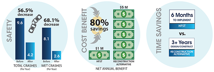
"Image depicts a comparison of safety on the treated road before and after, showing a 56.5 percent decrease in total crashes per year (from 9.6 before to 4.2 after) and a 68.1 percent decrease in wet crashes per year (from 8.1 before to 2.6 after). The cost benefit in terms of net annual benefit is an 80 percent savings, with the reconstruction alternative costing $5 million and the HFST application costing only $1 million. The time savings comparison shows a benefit with HFST, which takes only 6 months to implement, versus the reconstruction alternative, which was estimated to take more than 3 years for design and construction."

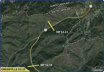
"Map of the one-mile section of Greenville US 25 treated with HFST. Copyright Google Maps."

A one-mile section of US 25 in Greenville County had been a cause for concern for the South Carolina Department of Transportation (SCDOT) for many years. Located in rural, mountainous terrain, and often subject to inclement weather including rain, snow, ice, and fog, US 25 carries traffic on two lanes in each direction and is separated only by a damaged and brittle concrete barrier. US 25 changes dramatically, from a relatively straight road in North Carolina directly to this particular section in South Carolina with horizontal and vertical curves and a 6 percent grade. US 25 has a speed limit of 55 mph and carries approximately 10,000 vehicles per day with heavy truck traffic.

SCDOT discovered a number of factors contributing to the high crash rates along this short section of US 25. One significant factor was that the concrete barrier's design did not allow for proper drainage, channeling water to the driving lane and shoulder. Speeding, inadequate pavement superelevation, and sight distance constraints also contributed to the safety issues at this location.

In 2000, SCDOT considered funding a major reconstruction project which involved replacing and updating the barrier wall and modifying the roadway's superelevation and drainage structures. However, with the project's estimate coming in at nearly $5 million, this project was unlikely to happen. Both costly and lengthy, the overall project development timeline for this alternative would have spanned approximately three years, and would have involved an extensive work zone and detour which would have inconvenienced local residents and drivers traveling through this area.

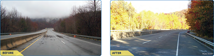
"Before and after photos of the treated roadway."

Over the years, low-cost measures of additional signing and markings were added along US 25, but these did not adequately address the excessive speeds and drainage issues, and the resulting safety improvement was minimal at best. At one point, a dynamic message sign (DMS) was installed to display a regulatory 45 mph speed limit during rainy conditions. However, due to the rural nature of this road segment and the wide road template, speeds remained excessive.

In 2008, a High Friction Surface Treatment (HFST) was applied to this curvy stretch of US 25. SCDOT had used this pavement treatment on ramp segments to increase skid resistance in locations where friction demand was high, but this one-mile project was the largest application to date, and at the time, it was unclear whether HFST would mitigate the hydraulic issues drivers experienced on this segment. With the planning process and installation complete in approximately six months, the HFST project cost SCDOT $1 million, which was 80 percent less than the previously considered reconstruction project.

A before and after study evaluating the HFST project's success on US 25 revealed significant safety benefits, with a 68 percent reduction in wet crashes and a 56 percent reduction in total crashes. Six years after HFST installation, SCDOT reports the pavement treatment is holding up very well, considering the high exposure to snow plowing.

To develop its current HFST specification, SCDOT used the AASHTO specification as the base model and integrated pieces from other States' specifications as well as their own experiences with the treatment. While their HFST specification is still evolving, SCDOT believes it strikes a good balance between quality materials and application, while still maintaining reasonable contractor expectations and competitive bidding.

Citing a before and after study of seven HFST project locations, SCDOT experienced an 81 percent reduction in wet crashes and 71 percent reduction in total crashes. Since HFST has proven to be a very cost-effective safety countermeasure, SCDOT has installed 20 HFST projects, with approximately 20 more locations planned for 2015. Widespread deployment will be incorporated once the DOT identifies the horizontal curves throughout the State. The benefit/cost analysis for these locations has proven HFST to be a very cost-effective countermeasure.

Contacts

Joseph Cheung
FHWA Office of Safety
Joseph.Cheung@dot.gov

Frank Julian
FHWA Resource Center
Frank.Julian@dot.gov

Joey Riddle
Safety Engineer
South Carolina DOT
RiddleJD@scdot.gov

A Life-Saving and Cost-Effective Solution For An Environmentally Sensitive Location

Original publication: Case Study: Northern California US 199-Del Norte County; FHWA-SA-15-055; 2015 (PDF, 2.3MB)


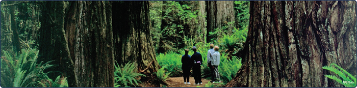
"Visitors to the national park admiring a stand of red wood trees. Photo: National Park Service."
Northern California, near the Oregon State line is home to the Redwood National and State Parks, which span over 200 square miles and are some of the most environmentally diverse areas in the United States. Accordingly, transportation construction projects that disturb existing conditions within the parks' limits are subject to stringent environmental restrictions and long permitting processes.


Background

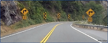
Over the last decade, a horizontal curve within the parks' limits experienced a high frequency of wet crashes. This curve, shown in Figure 1, is located on US 199, a two-lane, rural highway in Del Norte County, approximately one mile east of the South Fork Road intersection. It has a radius of 280 ft. and an advisory speed of 30 miles per hour (mph). Between 2006 and 2009, this site experienced 26 wet crashes and exhibited total and severe (fatal + injury) crash rates that were 7.3 and 4.3 times, respectively, greater than the statewide average for similar facilities. Crash types included run off road, head-on, and opposite direction sideswipe.

"US 199 in Del Norte County on the approach to a horizontal curve with curve warning signs, chevrons, and advisory speed placards. Photo courtesy of Caltrans."
Figure 1. US 199 in Del Norte County

Caltrans previously installed several low-cost safety countermeasures at the site including center line rumble strips, speed warning signs, double stacked chevron signs, and one inch open grade asphalt concrete (OGAC) overlay. Yet, these treatments did not lead to the crash reductions Caltrans desired. They began to consider larger scale countermeasures, specifically roadway realignment. However, the realignment process would require a lengthy environmental review and mitigation of wetland impacts before the improvement could begin reducing crashes. As an alternative to realigning this curve, Caltrans began to investigate a High Friction Surface Treatment (HFST) and looked to other States for guidance and successes.

Factors Affecting the Final Decision

"A marbled murrelet, photo courtesy of the National Park, and a northern spotted owl, photo by Larry Meade."
Figure 2. Threatened Species


Most critical for Caltrans at this location was mitigating environmental impacts. US 199 parallels the Smith River, the most pristine and environmentally sensitive river in California, protected by a full spectrum of environmental entities and regulations. The surrounding area sustains California's most diverse ecology, including the Marbled Murrelet and Northern Spotted Owl, as shown in Figure 2, both threatened species protected by the Federal Endangered Species Act. The area also contains over 400 separate species of plant life and a large number of active, very small wet lands.

Due to endangered species and water quality concerns, a roadway realignment project within the parks' limits would require Caltrans to spend six months acquiring environmental permits. Further, the North Coast Regional Water Quality Control Board requires Caltrans to mitigate construction effects upon the wetlands, even when impacts are only a few square feet. Wetland and impervious area mitigation ratios can range from 1:1 to 1:4 depending on several factors. If the replacement is to take place within another roadway project, it could be years before Caltrans is able to begin work on the initial project as crashes continue to occur. In contrast, HFST environmental impact and associated review is minimal and requires only a Categorical Exemption/Exclusion (CE/CE) document. HFST's nominal effect on the surrounding environment is due to the treatment's application between existing pavement edges, resulting in no net increase of impervious areas within the Park€™s limits.

In addition, any geometric improvement that involves construction incurs time restrictions (i.e., environmental windows) aimed at not disturbing wildlife. This would force Caltrans to either perform large-scale construction projects in stages or to use an accelerated/restricted schedule, both of which have significant effects upon the project. Conversely, HFST has the distinct advantage of an installation time period of just 10 working days.

HFST could be implemented quickly compared to alternatives, satisfying Caltrans€™ environmental concern, construction time schedule, and window of opportunity.

Lastly, a feasible detour route for the realignment is not available because a network of local county roads that connects the lower and upper portions of the county does not exist. A detour around US 199 could take longer than 8 hours, which is estimated to cost upwards of $450 million a year in associated economic losses. HFST can be installed one lane at a time and therefore does not require a detour at any point during construction.

Table 1 summarizes and compares each countermeasure's environmental review and design time frames, construction duration, costs, and need for a detour.

"Diagram shows that the environmental review and design timeframe is 4 to 6 months for HFST, compared with 2 to 5 years for curve realignment. Construction duration is 10 working days for HFST compared to 6 months or more for curve realignment. The cost is $250,000 for HFST compared to more than $14 million for realignment. A detour is not necessary for HFST because the treatment can be installed one lane at a time. For curve realignment, the road must be closed and a detour would be required during construction."
Table 1. Comparison of Factors between HFST and Curve Realignment on US 199


Selecting HFST

In summer 2012, Caltrans opted for the simpler, but still very effective, alternative. They installed 850 ft. of HFST at this horizontal curve on US 199, shown in Figure 3. The treatment consisted of a double layer of epoxy-resin binder with calcined bauxite aggregate, which filled in the surface voids from the previously installed OGAC and added protection against water penetration. With a peak hour volume of approximately 600 vehicles per hour (vph), Caltrans estimated only a 5 minute travel time delay during active construction. Caltrans is unaware of any crashes at this location since the HFST implementation.

To date, 139 sites on State maintained roadways in California have received HFST or will receive the treatment in the near future. Caltrans continually encourages and tries to educate its districts about the benefits of HFST. The agency believes that HFST is one of the best tools in its toolkit for challenging curves and should be the primary “go-to” friction enhancing countermeasure, even before OGAC.

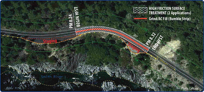
""Aerial photo of US 199 depicting the application area between PM 8.24 and PM 8.32, a 0.8 mile segment. Staging areas are indicated both in advance of the application area and along the final one third of the treated segment. A line along the center of the roadway throughout the treatment area indicates that the roadway here was treated with grinding/AC fill to create rumble strips. Photo courtesy of Caltrans.
Figure 3. US 199 HFST Application Area


What criteria does Caltrans use to install HFST?

Caltrans believes HFST is an appropriate safety countermeasure for both wet and dry locations, high and low volume roadways, and tangents as well as curves. It is effective at mitigating crashes involving large changes in speeds (acceleration/deceleration), low skid numbers, tight horizontal curves, and roadway departure. As a result, Caltrans has implemented HFST on a large variety of locations including horizontal curves, bridges, wet crash locations, signalized intersections, on- and off-ramps, and short freeway segments.

Are there any locations where HFST is not appropriate?

Caltrans does not apply HFST in cold/icy locations where heavy trucks frequently use chains in winter, as the chains significantly decrease HFST's lifespan. Further, in long tangent sections with intense rainfall, OGAC is preferred.

Contacts

Joseph Cheung
FHWA Office of Safety
Joseph.Cheung@dot.gov

Frank Julian
FHWA Resource Center
Frank.Julian@dot.gov

Florida DOT Sees Reduction in Teen and Lane Departure Fatalities and Injuries through the Local Agency Traffic Safety Program


Describe the roadway safety situation or state before the new practice was implemented. What was the safety issue, problem, or gap?

Presently, over half of the fatal and severe injury crashes in the Tampa Bay region occur on locally owned and maintained roadways. Traditionally, the Florida Department of Transportation (FDOT) has typically spent less than 10 percent of their allocated Federal safety funds on local roads. To aggressively address these fatal and severe injury crashes using a data-driven process, the District 7 (Tampa Bay region) office of FDOT developed and implemented the Local Agency Traffic Safety Program. The program is a coordinated and comprehensive effort to put the available safety dollars to use in reducing deaths and serious injuries on the roadways in the region.

What were the key challenges that needed to be addressed before the new practice could be implemented?

Prior to initiation of the program, the following challenges to allocating safety funding to the local agencies were identified:

  • Many of the local agencies did not have staff with specialized knowledge or training in traffic safety;
  • There was a general lack of knowledge among many of the local agencies about the available federal and state programs and the requirements of those programs; and
  • Agency staff typically did not know where to start to address the safety issues on their roadways.

Describe the new practice.

A comprehensive approach was developed to assist the local agencies with identifying the safety issues on their roadways, selecting appropriate countermeasures, and applying for funding to make the recommended improvements. The Local Agency Traffic Safety Program was developed to help build a culture of safety throughout the Tampa Bay region and includes:

  • A yearly Traffic Safety Summit in District 7 for local safety practitioners;
  • An online HSIP application process;
  • Safety ambassadors to work one-on-one with the agency staff to develop the candidate HSIP projects; and
  • Five methods of project delivery assistance by which local agencies can receive Federal safety funding to implement engineering improvements that have been selected for funding including:
    • Equipment purchase
    • Technical assistance
    • Design Build Push Button (DBPB)
    • Local Agency Program
    • Local Agency Force Account

List the key accomplishments that resulted from the new practice. Include the roadway safety improvements.

  • Achieved a 28 percent reduction in fatal and serious injury lane departure crashes and a 33 percent reduction in teen driver crashes over the last three years.
  • Completed over $23 million in safety improvements on local roadways in the Tampa Bay region.

What technical and/or institutional changes resulted from the new practice?

  • DBPB project delivery process allows a previously selected designer-contractor team to quickly bring a project “from concept to concrete.”
  • District 7 Safety Office Traffic Safety Summit.

What benefits were realized as a result of the practice?

  • Prior to the first Safety Summit, the District Safety Office would typically receive approximately three applications per year for safety funding on local roads. Since the inception of the Safety Summit and the support to the local agencies, the District Safety Office receives over 50 applications annually from the local agencies.
  • The program embodies the best of what FHWA is trying to achieve through its Every Day Counts initiative—making safety improvements through a multidisciplinary data-driven process as quickly as possible.
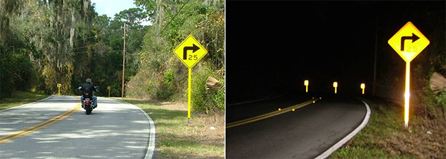
"daylight and nighttime photos of a curved road with brite sticks installed"
Brite Sticks Improve Visibility Day or Night


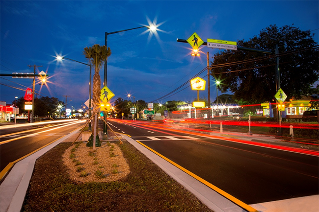
"photo of the mid-block pedestrian crossing on Fletcher Avenue"
Mid-block Pedestrian Crossing on Fletcher Avenue Complete Streets Project


Contact

Ping (Peter) Hsu, P.E.
FDOT, D7 Assistant District Traffic Operations Engineer (Safety)
813-975-6251
Ping.Hsu@dot.state.fl.us

Illinois Safety Portal Makes Key Data Easily Available to Safety Stakeholders


Describe the roadway safety situation or state before the new practice was implemented. What was the safety issue, problem, or gap?

For years, Illinois county engineers wanted access to crash reports for their studies. State legislation was changed to include local governmental agencies, but they still had to sign an inter-governmental agreement with the Illinois Department of Transportation (IDOT) to receive the reports.

What were the key challenges that needed to be addressed before the new practice could be implemented?

The existing legislation 625 ILCS 5/11-408 of the Illinois Vehicle Code states:

“Upon request, the Department (IDOT) shall furnish copies of its written accident reports to Federal, State, and local agencies that are engaged in highway safety research and studies. The reports shall be for the privileged use of the Federal, State, and local agencies receiving the reports and shall be held confidential.”

As a result, the inter-governmental agreement was required to access the data.

Describe the new practice.

The Safety Portal was developed and launched in August 2014 to allow Illinois local government entities to view their crash reports. This project includes various tools that provide crash report(s) search capabilities, Geographic Information Systems (GIS) mapping for identified crash reports, on-line training materials for law enforcement agencies, and predefined crash data summary reports. The target end users for the Safety Portal include IDOT staff; National Highway Traffic Safety Administration (NHTSA) representatives; Federal Highway Administration (FHWA) representatives; Federal Motor Carrier Safety Administration (FMCSA) representatives; Illinois County Engineers and staff; Metropolitan Planning Organizations in Illinois; and state, county, and local law enforcement agencies.

The Safety Portal is one place all these entities can now view Illinois crash reports and data summaries without signing agreements with IDOT. End users do, however, have to agree to comply with a Confidentiality Statement before they can gain access to the Safety Portal. For end users to gain access to the Safety Portal, they must be approved by a “Vetter.” Vetters are people who have the authority to approve individuals from their respective agencies/jurisdictions for access into the Safety Portal.

List the key accomplishments that resulted from the new practice. Include the roadway safety improvements.

  • As of the beginning of calendar year 2015, IDOT had received 599 Vetter Registration forms from law enforcement agencies, county highway departments, IDOT, FHWA, and FMCSA.
  • A total of 520 users were registered and approved for access to the Safety Portal. Of those, 85 are with IDOT, 351 are with law enforcement agencies, 81 are with county engineers, 2 are from the FHWA, and 1 is from the FMCSA.
  • As of April 3, 2015, there are 869 registered end users. This number continues to climb each week.

What technical and/or institutional changes resulted from the new practice?

The Safety Portal allows users to obtain important crash information. The tool eliminated the need for agencies to sign inter-governmental agreements.

What benefits were realized as a result of the practice?

  • The former Chairman of the County Engineers Safety Committee indicated their membership feels the Safety Portal is an excellent tool that advances their ability to access critical data and crash reports for their counties. They are excited to have all 102 of their Association members registered, along with their respective staff.
  • IDOT has also received feedback from local Chiefs of Police indicating this tool will be invaluable for their search of historical records. One Chief commented that now he will not have to dig through old filing cabinets to find crash reports from three to five years ago, instead he has simple access to them through the Safety Portal.

Contact

Jessica Keldermans
DTS—Bureau of Safety Data & Data Services
Bureau Chief
(217) 785-3062
Jessica.Keldermans@illinois.gov
www.idot.illinois.gov

Washington State DOT Implements $26 Million in Local Roadway Safety Improvements through Local Agencies


Describe the roadway safety situation or state before the new practice was implemented. What was the safety issue, problem, or gap?

Highway Safety Improvement Program (HSIP) funds in Washington State are divided between State highways and local agency roadways. The funds are split according to the top priority infrastructure emphasis areas from the State Strategic Highway Safety Plan (SHSP): Target Zero. The top priority, or priority 1, emphasis areas are run-off-road crashes and intersection-related crashes. The split between State and local share of those crashes has remained very consistent at roughly 30 percent on State maintained roadways and 70 percent local agency responsibility. Therefore, 70 percent of HSIP funds are provided to local agencies through programs administered by the Local Programs division of the Washington State Department of Transportation (WSDOT).

From 2010 to 2014, county roads accounted for 25 percent (2,801 of 11,259) of all fatal and serious injury crashes in Washington State. However, those crashes are spread out over more than 39,000 miles of road. Very few locations have more than one fatal or serious injury crash over a five-year period. This seemingly random pattern makes implementation of safety countermeasures more challenging.

Since 2009, counties applying for HSIP funds have been required to implement low-cost improvements over widespread areas of their network. Projects have been awarded to all 39 counties statewide in that time period. Counties are allowed to identify which countermeasures they implement and where they are implemented, as long as they address fatal and serious injury crash types (primarily run-off-the-road) using proven countermeasures. Counties are responsible for identifying priority locations using this risk-based approach to safety.

What were the key challenges that needed to be addressed before the new practice could be implemented?

Counties had to be provided with the resources to develop local road safety plans to identify locations and priorities for road safety projects. The resources included statistical summaries, development of workshops, and coordination of training through the Federal Highway Administration's (FHWA) Data and Analysis Technical Assistance program.

Describe the new practice.

Counties are required to develop a local road safety plan to identify locations and priorities. The development of such a plan is required in order for a county to be eligible to apply for HSIP funds. WSDOT assisted the counties with the development of local road safety plans in the following manner:

  • Counties were provided with summary data to help them prioritize crash types, roadway characteristics, and conditions more prevalent in fatal and serious injury crashes.
  • A series of eight workshops were held around the state for counties to better understand the requirements of the local road safety plan. These workshops helped to emphasize no new data are needed to be collected to develop a local road safety plan.
  • During the workshops, counties were provided with additional resources, such as the Systemic Safety Project Selection Tool and the SHSP recommended countermeasures.
  • After the workshops, training specific to the Systemic Safety Project Selection Tool was made available to counties (and a few interested cities).
  • Technical assistance was provided as needed for any county requesting assistance in development or review of their local road safety plans and HSIP applications.
  • For the final application for HSIP funds, counties were required to develop a list of prioritized projects, each with a separate cost estimate.
  • If counties could advertise new safety projects by September 30, 2016, the state would provide the 10 percent match typically required from the local agency, allowing the counties to receive 100 percent funding for construction.

List the key accomplishments that resulted from the new practice. Include the roadway safety improvements.

  • The majority of counties completed a local road safety plan and applied for funds within a five-month window from the announcement of the program to the application deadline.
  • Of those that applied, 30 counties received funding for a total of $26.5 million in improvements.
  • Nearly every project, in every county, committed to meeting that deadline in order to receive 100 percent construction funding support.

What technical and/or institutional changes resulted from the new practice?

The development of local road safety plans has a high potential to reduce fatal and serious injury crashes on the county road network. This approach is data-driven, creates a process to determine risks across the network, and provides the flexibility to select the most cost-effective projects. This approach is also changing the safety culture among counties across the state by making them evaluate their roads in a different way than before.

What benefits were realized as a result of the practice?

  • Two key partnership opportunities also emerged from this process including the Washington State Association of Counties (the state's NACE-affiliate) and the County Road Administration (CRAB).
  • CRAB received a Traffic Records Committee grant to develop a safety module that works with their existing database. This will allow counties to combine crash, roadway, and volume data to develop a systemic safety program. The module will help to implement the Systemic Safety Project Selection Tool analysis process.

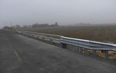
"photo of the installed bridge guard rail"

Bridge guard rail installation as a result of a local road safety plan

"photo of updated signs on a roadway that curves ahead"

Signage updates as a result of a local road safety plan

Contacts

Matthew Enders, PE
Manager, Technical Services
(360) 705-6907
EndersM@wsdot.wa.gov

Susan Bowe, PE
Traffic Services Manager
(360) 705-7380
BoweS@wsdot.wa.gov

Florida DOT Develops Comprehensive Coalition to Address and Assist Aging Drivers


Describe the roadway safety situation or state before the new practice was implemented. What was the safety issue, problem, or gap?

Today's older adults are not only living longer; they are continuing to drive longer than any generation in history. Research suggests older adults can expect to outlive their ability to drive safely by seven to ten years. Florida has a significant number of aging road users with 18.2 percent of its population over age 65. This percentage is expected to grow to 27 percent by 2030, a figure substantially higher than the national average of 19.7 percent.

As an increasing number of older adults drive on Florida's roadways or travel the roads as pedestrians, passengers, bicyclists, motorcyclists, or transit riders, the issue of transportation safety becomes a greater public health concern. In 2013, there were 454 fatalities involving drivers age 65 and older, which is over 19 percent of all fatalities.

What were the key challenges that needed to be addressed before the new practice could be implemented?

The Florida Department of Transportation (FDOT) created a Safe Mobility for Life Program within its Traffic Engineering and Operations Office which quickly expanded as an increasing number of stakeholders became involved with the program. The program originally focused on engineering improvements on the state highway system to compensate for the natural changes that occur as people age. Human factors studies were soon incorporated into the program, in conjunction with the Florida State University Department of Psychology, to gain a better understanding of how traffic control devices are comprehended by all age groups prior to implementation. A training course was later developed and tailored to the Federal Highway Administration's (FHWA) Highway Design Handbook for Older Drivers and Pedestrians to address the unique aspects of Florida's transportation system and take into account competing design practices such as Context Sensitive Design/Solutions and Livable Communities. With an ever increasing number of activities associated with the program, FDOT needed to develop a better solution to integrate its various partners into the program.

Describe the new practice.

FDOT partnered with the Pepper Institute on Aging and Public Policy at Florida State University to form a statewide coalition. The Safe Mobility for Life Coalition (SMFLC) consists of 27 agencies and organizations who share responsibilities and interests in aging road user safety and mobility.

Activities developed or supported by the Coalition that have helped Florida achieve reductions in aging road user traffic related fatalities and serious injuries include:

  • Roadway and Pedestrian Improvements: Safety countermeasures including larger lettering on signs, advance warning signs, countdown pedestrian signals, etc.
  • Dedicated website (safemobilityfl.com): A one-stop website created and maintained by FDOT to put aging road user transportation safety and mobility tools and resources all in one place.
  • Florida's Guide for Aging Drivers: This free guide was developed as a printed version of the FLsams website and is designed to help Floridians learn how to continue to safely drive while also sharing information to help prepare and plan ahead to meet their mobility needs after transitioning from driving.
  • Find-a-Ride Database: This database, generated by the University of Florida, provides direct access to over 800 local transportation options through the Find-a-Ride page on the FLsams website.
  • Aging Road User Survey: This survey conducted in September 2012 and again in 2013 saw an increase in the number of people who had heard about SMFLC as well as an increase in the number of individuals who indicated they were preparing for when they could no longer drive.
  • Safe Mobility for Life Resource Center: Coalition materials that promote and educate on aging road user safety and mobility are distributed upon request to all stakeholders, including the guide, checklist, brochures, and tip cards that support the Aging Road User Strategic Safety Plan.

List the key accomplishments that resulted from the new practice. Include the roadway safety improvements.

  • The proportion of traffic fatalities in Florida involving drivers ages 65-74 was below the proportion for both the NHTSA Region 4 and the nation during the last three years (2011-2013).
  • Broadcasted three focus group tested radio public service announcements targeting urban and rural priority counties in 2014.
  • Conducted an Assessment of Health Care Providers and Older Adult Service Organizations research project with results used to develop and distribute educational materials and resources.

What technical and/or institutional changes resulted from the new practice?

The Coalition developed the Aging Road User Strategic Safety Plan, which is incorporated in Florida's Strategic Highway Safety Plan under the At-Risk Drivers Emphasis Area. The Aging Road User Strategic Safety Plan is broken down into 10 key emphasis areas:

  • Advocacy and Policy;
  • Aging in Place;
  • Assessment, Remediation, and Rehabilitation;
  • Data Collection and Analysis;
  • Licensing and Enforcement;
  • Other Road Users;
  • Outreach and Education;
  • Prevention and Early Recognition;
  • Program Management, Evaluation, and Resources; and
  • Transitioning from Driving.

The plan includes specific emphasis areas and tracks their progress and implementation to ensure that the overall plan is moving forward.

What benefits were realized as a result of the practice?

  • Developed specialized materials that focus on older driver related transportation safety issues.
  • Held special events including: an indoor/outdoor interactive Safety is Golden Mobility Fair to provide available local transportation safety and mobility resources to participants; a Transit is Golden safety event to help educate and promote the use of public transportation among older adults by walking to a bus stop and traveling to a local destination; and a Stop on Red safety event in collaboration with Alert Today Florida to promote pedestrian safety.
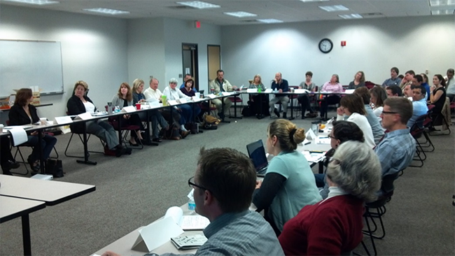
"photo of the quarterly meeting members sitting at tables arranged in a 'U' shape"
Safe Mobility for Life Coalition members attend quarterly meeting in Tallahassee, FL


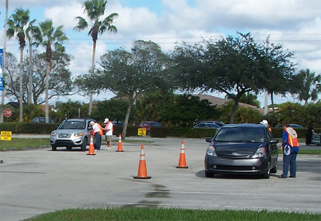
"photo of a CarFit event"
Members working as trained technicians at a CarFit event in Tamarac, FL


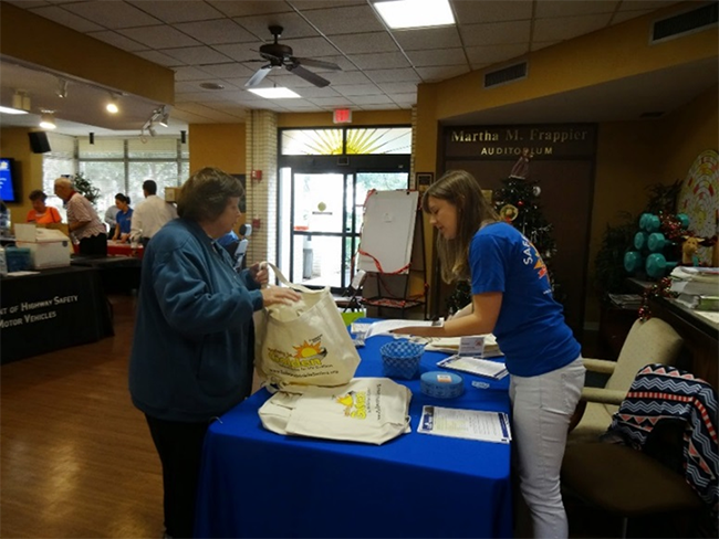
"photo at an information booth at the fair"
Distributing safety information at the Safety is Golden Mobility Fair in St. Petersburg, FL


Contacts

Safe Mobility for Life Program
Florida Department of Transportation
State Traffic Engineering and Operations Office
605 Suwannee Street, MS 36
Tallahassee, Florida 32399-0450
Gail.Holley@dot.state.fl.us
850-410-5414

Pepper Institute on Aging and Public Policy
Safe Mobility for Life Resource Center
636 West Call Street
Tallahassee, FL 32306
Safe-Mobility-For-Life@fsu.edu
850-644-8145

Michigan DOT Reduces Crashes by 47 Percent by Implementing a Centerline Rumble Strip Initiative


What was the safety issue, problem, or gap?

From 2004-2007, lane departure crashes accounted for 17.2 percent of all crashes in Michigan, but 47.4 percent of all fatal crashes. Michigan Department of Transportation (MDOT) recognized that while the type and severity of the crashes had similarities, the location at which they occur is random. As a result, MDOT began a three-year statewide initiative in 2008 to install milled centerline rumble strips on all rural non-freeway highways with a posted speed limit of 55 mph, eventually including approximately 5,400 miles of non-freeway roadways. MDOT also installed shoulder rumble strips (SRS) on roadways with paved shoulders of at least 6 feet in width. This systemic initiative is to date the largest of its kind in the United States and provided a unique study opportunity. Consequently, MDOT wished to evaluate the impacts of these rumble strip installations on traffic safety and operation and pavement durability to provide guidance for future implementation both in Michigan and in other states. This evaluation study primarily focused on safety effectiveness of centerline rumble strips (CLRS), since the effectiveness of SRS had previously been established through numerous nationwide research and studies.

What were the key challenges that needed to be addressed before the new practice could be implemented?

  • MDOT had to ensure that stakeholders were involved in the process and developed and circulated survey to capture the opinions and input of various road users.
  • Additionally, MDOT developed a pair of rumble strip-based public service announcements for outreach.
  • The installation of the rumble strips needed to be expedited in order to ensure valid research results.

Describe the new practice.

  • Centerline rumble strips are a set of transverse grooves applied on the centerline of a roadway to alert inattentive (distracted, drowsy, unfocused, etc.) drivers who may unintentionally drift over the centerline.
  • Rumble strips provide a tactile and audible warning to alert drivers.
  • In 2008 MDOT began a three-year statewide CLRS installation initiative, including approximately 5,400 miles of 55 mph, non-freeway roadways over the three-year installation period.
  • To efficiently roll out the rumble strip installations, the contracting process was streamlined by adding the work items to MDOT's annual pavement marking contracts with the direction to cut the rumble strips ahead of restriping the roadways.
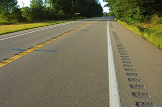
"photograph of a road with non-freeway shoulder and centerline rumble strip installation"
Non-Freeway Shoulder and Centerline Rumble Strip Installation – M-66 in Calhoun County, Michigan


Key accomplishments, including roadway safety improvements.

  • 47 percent reduction in total target crashes (head-on, sideswipe opposite and run-off-the-road left) and a 51 percent reduction in target fatal crashes, as well as reductions in other injuries
  • Economic analysis resulted in a benefit-cost ratio in the range of 58:1 to 18:1 based on discount rate assumptions of 2 percent and 10 percent, respectively
  • A road user survey indicated strong agreement among the respondents that CLRS are a beneficial safety improvement program

What technical and/or institutional changes resulted from the new practice?

  • As a result of the initiative's success, installation of CLRS has become standard practice on trunkline routes in Michigan.
  • Language in MDOT's Road Design Manual now dictates that CLRS be installed on all 55 mph 2- and 4-lane highways (regardless of whether a section is a passing or non-passing zone) where the lane plus paved shoulder width beyond the rumble strip exceeds 13' in width, with exceptions for high driveway densities and the presence of horse drawn buggies.

What benefits were realized as a result of the practice?

  • Rumble strips on high-speed non-freeway highways improved driver performance in most traffic scenarios.
  • CLRS did not contribute to short-term transverse cracking in asphalt pavements.

Contact

Mary Bramble
517-335-2837
BrambleM1@michigan.gov